This is a long post, with a lot of pictures, so bear with me, and I'll try to keep the words as few as possible.
If we look tired, it's because we were up late getting ready to go, and up early to get our hut passes. But we have them! And we are off and ready to go hiking!
But first, we have to get 100km away to a trail head at the end of a dirt road. Oops. Well, thumbs out and with our biggest smiles on, we start hitching.
Our first ride was a nice woman from Invercargill, who gave us a ride out of town to the intersection of the highway we needed to be on.
Then another hitch to Riverton, 30km away. In the middle of using the public restroom, there was an unexpected power outage, which made finishing up rather...um...interesting.
From Riverton, a retired man and current possum trapper (our third to meet on this trip so far) promised to take us another 40km down the road, but couldn't take us any further because he had some poison traps to check on.
From him, we learned that the price of possum fur has gone up since we first arrive in New Zealand. When we first arrived, it was selling for $80 a kg, but now was up to $120. Also, as winter approaches, and the possums put on more fur, it takes fewer possums to get each kg. In the summer, 15-20, but in the winter, as few as 8 skinned possums could get you a kilogram.
Also, he took it upon himself to be a bit of a tour guide, and kept taking us down side roads to see the southern coast of New Zealand.
We decided it was perhaps the most Scottish-looking part of the country we'd seen--sheep everywhere, very green, and rolling hills rather than mountains.
With a bit of Maine rolled in there, too. This little place is called "Cosy Nook". It's a fishing cove.
The huts all have little boat rails to get fishing boats in and out of the water; at low tide, they would simply founder on the rocks.
We were also told that the cottages were all technically illegal, since this was public land, but had been there long enough that if no one raised a stink, the government didn't care too much.
As you can see, the weather was also somewhat unpredictable. From clear skies to rain and back to clear skies in the space of half an hour.
Our last hitch of the day was a great stroke of luck. We were picked up by a man whose job is to monitor lobster fishing around the coast of the South Island, and was on one of his twice yearly trips to check on and set new traps for his job. So when we said, "Hey, we're heading to this one coastal hiking track, and it's a bit off the road," his reply was, "Great! I was headed in that general direction anyway, so I can write off the extra 20km anyway." Gotta love Kiwis.
And we're ready to start the hike.
The beginnings of trails always hold a lot of promise. This one was no exception.
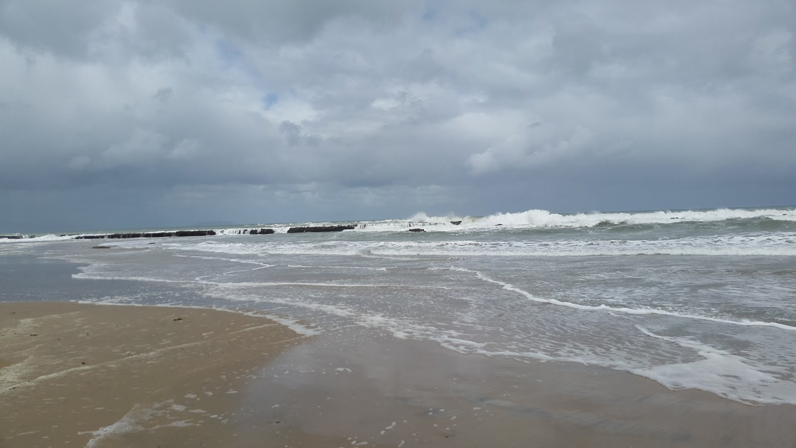
After 5 or 6 km of hiking through the woods, we came down to this beach. And 5 km more of hiking with this view. The track is called the "South Coastal Track" and to this point, it lived up to the name.
Our hut for the first night of our hike. The area was a logging town called Port Craig, and the school house was converted into a 14 bunk hut for campers. Very cosy, and nice, but the wood burning stove didn't draw at all, so while it kept the place relatively warm, it smoked constantly, which required keeping windows open, which kept the place a little cooler than it could have been.
Day 2 of the hike, leaving the school house.
The days hike was supposed to follow the train line used to collect logs for the logging village, which we were initially excited about. Train lines mean good grading, and usually solid places to walk.
Much like this.
Or even this.
And some pretty impressive viaducts over gorges. These date back to the turn of the 20th century, when logging was at its peak here.
Until we came to this. The largest of the viaducts was shut down, due to the fact that without repairs, the structure was dangerous.
It's impressive, but the trail down to the bottom of the gorge and back up again took half an hour, rather than the 3 minutes it would have taken to walk across.
The birds in New Zealand are rarely shy, by the way. This one hopped around, only inches from my boots, for several minutes, even as I fumbled for my phone to take a picture.
In any case, after the shuttered bridge, the trail took a turn for the worst. It was still the train line, so still graded, but had not been improved for many many years, or even at all. In other words, it became a muddy mess. A combination of the massive rain falls that Southern New Zealand is known for, the very slight grade of the trail, and a lack of drainage meant that we were often wading through shin deep mud. The sleepers (rail ties) were still there, but often covered in the mud, and if you counted on them to try to cross through and missed with your foot, you could easily end up knee deep in mud, or with a twisted ankle. Not too much fun.
And remember that this is the South COASTAL Track? We didn't see the coast at all that day. The train line was always around 1km from the coast, so we could hear waves, but not see them.
But our hut passes were already paying dividends; here's where we stayed the 2nd night.
And the river just next to it.
And the cool cable bridge spanning the river.
There was a privately owned lodge across the river, which we explored a bit.
And finally, the next day, we walked down to the coast.
It was here we made a critical decision. The next day, according to the map, would have no more coastal views than the 2nd day, and probably just as much mud. We had wanted to hike this far South to get a feel for the South coast, and we decided that 2 days out and 2 days back was enough of said feel, rather than the original plan of a 7 day trip. There are plenty of beautiful places in NZ, and only so much time.
So back across the bridge.
And the viaduct.
And the rail trail.
There are even some rusted remnants of the area's past.
A view of the coast, back at Port Craig, were we stayed our 3rd night.
And wandering around the area. There's quite a few old bits and pieces of the various equipment used to cut, strip, mill, and transport the logs the town was built for.
And, of course, lots of natural beauty, too.
The next morning, at sunrise.
So here is another reason why our turning around after only 2 days was momentous. If you think way back, back when we hiked the Inland Track of Abel Tasman, you'll remember that we stayed in a full hut, and one of our fellow campers was a Frenchman named Kevin. Well, against many odds, who should we find when we arrived back at Port Craig but Kevin, only 700kms further South and 3 months later.
That's Kevin. He's been traveling around NZ, camping and hiking, and occasionally working while we were doing essentially the same thing. The big thing is, however, is that he has a car. Even if we do make it to the trail head on day 4, we have no way of getting back to the main road to hitch to the next place to camp. But we decided to hitch our wagons to Kevin for a while, and try to convince him to take us on from there. It was a decision we'd both appreciate and regret later.
That shadow is me. This was on a cable bridge a good 30 feet above the bottom of this gorge.
And back to the beach the next day.
Back at the trail head, a helicopter. The South Coastal Track intersects a privately run track and series of huts/lodges called the Hump Ridge Trail, and for a price you can have your luggage flown to the huts, including the one on top of the Hump Ridge, at 3000 ft.
Some views from Kevin's car, as we drove back to the town of Tuatapere (Too-a-tap-a-ree) to decide our next move.
Molly and I wanted to hike in the Takitimu (Tok-e-tea-moo) Mountains next. We had read about them in Wilderness Magazine, New Zealand's quite excellent monthly journal of hiking and camping. Kevin, who we were realizing might be slightly off (nice enough, but perhaps on the spectrum) was completely unwilling to simply jump on a trail without planning, so while he promised to drive us to the trail head and hike with us, he would not do so without getting some sort of map, and since it was getting late, insisted that we spend a night in town. So we booked a room at the local motel, and Kevin slept in his car (to save money). We would leave the next morning.
And the sunsets still are impressive, even though it's not Australia anymore.


Wow! Thanks for sharing. Miss you both. Mónika
ReplyDeleteWow! Thanks for sharing. Miss you both. Mónika
ReplyDelete